Save
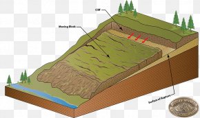
User Rakinshu uploaded this Map - Lidar Map Landslide Geology Elevation PNG PNG image on March 2, 2018, 10:08 pm. The resolution of this file is 1153x972px and its file size is: 1.31 MB. This PNG image is filed under the tags:
Map - Lidar Map Landslide Geology Elevation PNG
Below are more related PNG images...