Save
User oltff64 uploaded this Map - Map Line Point Elevation Angle PNG PNG image on March 28, 2018, 2:04 am. The resolution of this file is 715x955px and its file size is: 55.27 KB. This PNG image is filed under the tags:
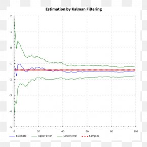
Map - Map Line Point Elevation Angle PNG
Below are more related PNG images...