FAVPNG
browselogoscalendar
log insign up
 
  • Browse PNG's
  • Famous PNG Logos
  • Events Calendar
  • Popular PNG's
  • Newest PNG's
  • PNG's by Color
  • AI Background Remover
  • AI Image Editor
  • Help / FAQ

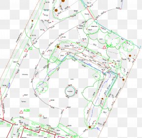
Land Survey PNG Images

- 54 free transparent PNG images matching "Land Survey"

Land Surveying
  • Surveyor Measuring Land PNG
  • Land Surveyor With Theodolite PNG
  • Surveyor Using Theodolite PNG
  • Surveyor Using Theodolite PNG
  • Surveyor Using Yellow Theodolite PNG
  • Surveyor Using Total Station PNG
  • Surveyor Using Tripod Theodolite PNG
  • Surveyor Using Tripod Instrument PNG
  • Surveyor Using Theodolite On Site PNG
  • Surveyor Using Theodolite Instrument PNG
  • Luxury Frame - Hotel South San Francisco Map Public Land Survey System Fare PNG
  • Book Corner - Public Land Survey System Quarter Section Bearing Angle PNG
  • Tucson Surveying Land Surveyor American Land Title Association Real PropertyLand Surveyor - Arrow Land Survey Inc PNG
  • Marketing - Lemke Land Surveying Surveyor Marketing Brand Management PNG
  • Water - Dakos Land Surveys, Inc. Black & Veatch Water Services Information PNG
  • Land Surveyor - Eric Nielsen Land Surveying Surveyor Real Property Cocoa Brass PNG
  • Land Surveyor - Land Surveys Surveyor Construction Civil Engineering Company PNG
  • Ship - Ship Survey Vessel Navy Clip Art PNG
  • United States - United States Geological Survey Tree National Land Cover Database PNG
  • Business - Association Of Ontario Land Surveyors Cadastral Surveying Business PNG
  • Bureau Of Land Management Public Land Federal Government Of The United States Government Agency United States Forest Service PNG
  • Moon - Apollo 11 Moon Lunar Reconnaissance Orbiter Topography United States Geological Survey PNG
  • Contour Line - Topographic Map Contour Line Topography Ordnance Survey PNG
  • Map - Map Indiana Department Of Transportation Surveyor Geographic Data And Information Aerial Survey PNG
  • Map - Illinois Natural Resources Conservation Service Soil Survey Map Soil Type PNG
  • Map - Square Mile Wards Of The City Of London Map Ordnance Survey PNG
  • Business - GEOPLAN Surveying Ltd. Surveyor Topography Building Surveys Business PNG
  • 104km SSE Of Pangai, Tonga 2018-05-13 Matthew 2:20–21 EarthquakeOthers - Land Of Israel M 6.1 PNG
  • Land Surveyor Civil Engineer Engineering Elementary Surveying: An Introduction To Geomatics PNG
  • Podium Automotive Center - Prairie Research Institute Illinois Land Registration RAND Corporation PNG
  • Fishing Trawler - Amphibious Warfare Ship Fishing Trawler Dock Landing Ship Submarine Chaser PNG
  • Cloud Contour - Land Surveyor Computer Software Topography Plan PNG
  • Customer Review Auto Land Customer Service PNG
  • United States - United States World Map Western Australia Australian Marriage Law Postal Survey PNG
  • Social Media - Social Media Marketing Advertising High School Survey Of Student Engagement PNG
  • Quarry - Cheshire Surveys Ltd Architectural Engineering Merseyside Service PNG
  • Fifty Years - Cooper Aerial Survey Surveyor Virtual Assistant Geoscans PNG
  • Hydropower Station - Honda Motor Company Honda Civic Honda HA-420 HondaJet Geosciences, Geology, Mapping, Cartography, Yukon Geological Survey PNG
  • Many Storied Buildings - Questionnaire Inquiry Ethics, Morality And The Land Question In Baltimore PNG
  • Organization Climate Change Tourism Sustainability Tour Guide PNG
  • GEOMATICS SURVEY CONSULTANTS SDN BHD Land And Survey Department Sarawak Malaysia Facebook, Inc. Directional Drilling Bumiputera PNG
  • Map Icon Maps & Location Icon PNG
  • Survey - Surveyor Photography Silhouette PNG
  • 3d Map - Unmanned Aerial Vehicle Photogrammetry Rapid 3D Mapping Aerial Photography PNG
  • Life Insurance Buck Vermessung Öffentlich Bestellter Vermessungsingenieur (ÖbVI) Beratender Ingenieur Dentistry PNG
  • Carrot Plant - Parsnip Parsley McCarrons Lake Wildflower Soil Map PNG
  • Map - Barre Library Of Congress North Abington Baldwinville Map PNG
  • Oil Tanker - Fast Combat Support Ship Tanker Cargo Transport PNG
  • Geodesy Инженерно-геодезические изыскания Топографическая съёмка Geotechnical Investigation Geology PNG
  • Ship - Ship Desktop Wallpaper Clip Art PNG
  • Lancha - Missile Boat Patrol Boat Fast Attack Craft Heavy Cruiser Ship PNG
  • Criticism - Traffic Sign Image Falkland Islands Road Market PNG
  • Ship - T&D RECRUITMENT Ship Image Yacht PNG
  • National Agricultural Statistics Service United States Department Of Agriculture Logo United States Of America PNG
MapSurveyorAreaTopographyGeodesist With Theodolite EquipmentConstructionBusinessLand LotBrandLogoFieldworkEngineeringTripodLand SurveyorCivil EngineeringTextTheodoliteEngineerShipSurvey VesselResearch VesselNaval ShipPatrol BoatWatercraftMeko
BirthdayShopping BagFilm ReelBrush TeethMagnifying GlassBoatTennis BallChristmas StarJudgeChampagneLightning BoltSlothPancakeBlurWater SplashQuotesRunningSeahorseQueen CrownVineBapeShipPinterestBraBasketMusical InstrumentsWater DropSeaMore Popular Searches
TOOLS
AI Background Remover
Image Editor
CONTENT
Famous PNG Logos
PNG Events Calendar
PNG's by Color
Popular Searches
Popular PNG's
Browse
ABOUT
Terms of Service
Privacy Policy
Help / FAQ
Contact Us
DMCA
Millions of stunning royalty-free PNG images. *
© 2026 FAVPNG.com - 0.010