Save
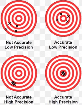
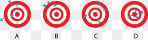
User alisarfraz uploaded this Control Point - Aerial Survey Surveyor Unmanned Aerial Vehicle Map Accuracy And Precision PNG PNG image on November 29, 2024, 2:00 pm. The resolution of this file is 750x609px and its file size is: 542.72 KB. This PNG image is filed under the tags:
Control Point - Aerial Survey Surveyor Unmanned Aerial Vehicle Map Accuracy And Precision PNG
Below are more related PNG images...